Hive mind: scientists use flying hexagon to study ground water
It’s not a bird or a plane, it’s a giant research hexagon which will be hovering over Friesland and much of the rest of the Netherlands from this week.
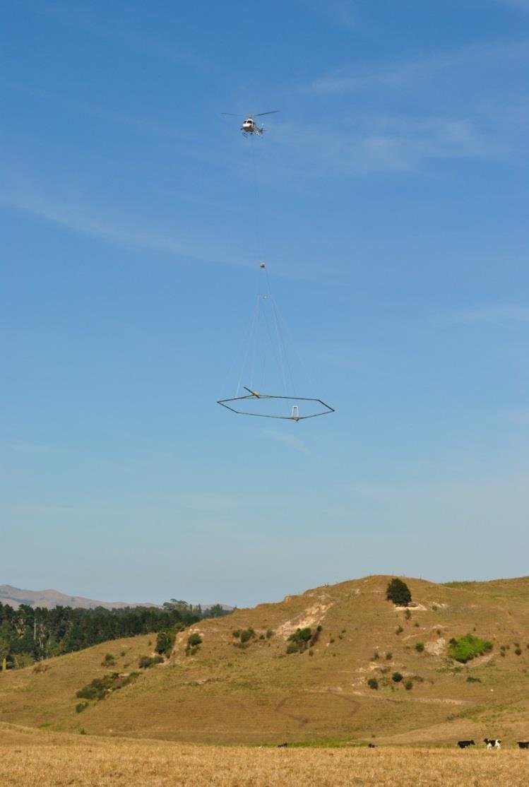
Scientists from two research institutes, seven provinces, five water companies, and seven water boards are using a hexagonal structure carried by helicopter to conduct groundwater and subsurface research.
The ring creates an electromagnetic field. “Because different soil layers and fresh and salt water react differently to this, we can see what’s where,” TNO researcher Jan Gunnink told broadcaster NOS.
The main goal is to figure out if the groundwater has become saltier. Salinisation creates problems for the environment, agriculture, and drinking water supplies.
To prevent fresh water from becoming salty, water management organisations need to know where the groundwater is already saline and where it is not.
The ring will be flown 35 to 50 metres above ground in a straight line to map the entire area.
For this project, two helicopters will fly 25,000 kilometers in total – equivalent to nearly halfway round the world. One will depart from Friesland and map the northern provinces. The other will cover Zeeland and part of North Holland.
The research will be carried out until February 2026.
Thank you for donating to DutchNews.nl.
We could not provide the Dutch News service, and keep it free of charge, without the generous support of our readers. Your donations allow us to report on issues you tell us matter, and provide you with a summary of the most important Dutch news each day.
Make a donation