Dutch river water levels reach peak as flood risk continues
See more DutchNews articles in your Google search results
See more DutchNews articles in your Google search results
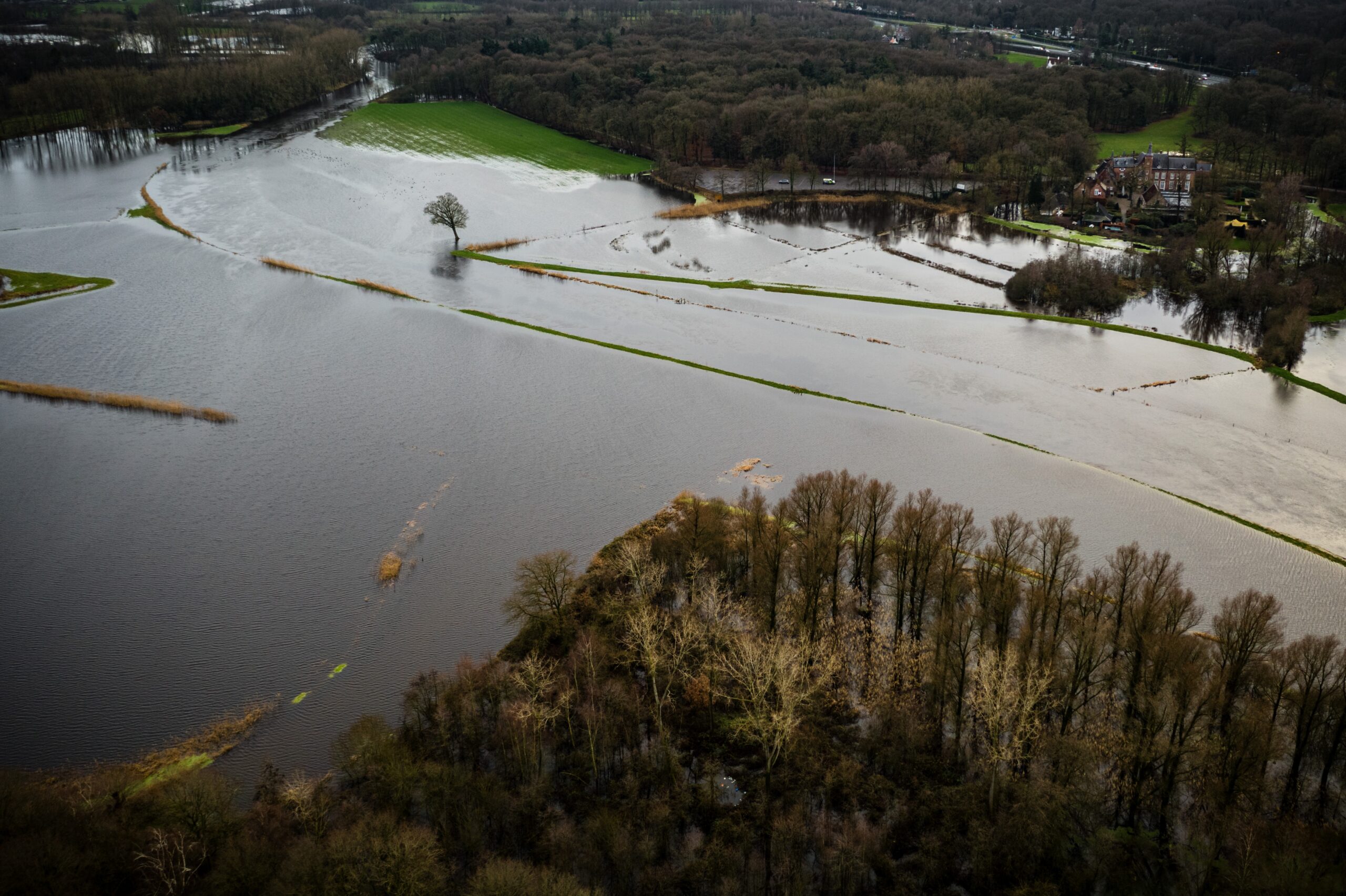
Add as a favourite source on Google Add DutchNews as a favourite source on GoogleWater levels in the big Dutch rivers are set to reach their highest level on Thursday, following weeks of heavy rain plus severe weather in Germany.
At just after 4 am, the level in the river Rhine at Lobith, at the border with Germany, reached 14.52 metres above NAP but has now sunk slightly, officials said.
NAP stands for Normaal Amsterdams Peil or the normal water level in Amsterdam, which is slightly lower than sea level. NAP is used as a base to measure how high or low water levels are in Dutch rivers. So when the river Rhine is high, it is described as a certain number of metres ‘above NAP’.
During the last serious floods, in the 1990s, the water level at Lobith reached 16 metres above NAP.
The peak water volume will now spread gradually through rivers across the country as the water moves down towards the sea.
There has been some localised flooding along the Waal and the IJssel where sandbags are being used to keep the water at bay. In Deventer, where the flood risk is most acute, the river banks have been raised 10 centimetres with hundreds of sandbags.
Loevestein castle, near Zaltbommel, has been closed to the public until January 2 because it has been cut off by flood waters.
A spring tide on Friday could cause additional problems as water backs up from the sea but water board chiefs say there is enough capacity on the flood plains to absorb the excess water.
The situation is more serious in Germany where thousands of emergency service workers and volunteers have been working to prevent flooding, particularly in Lower Saxony.
Thank you for donating to DutchNews.nl.
We could not provide the Dutch News service, and keep it free of charge, without the generous support of our readers. Your donations allow us to report on issues you tell us matter, and provide you with a summary of the most important Dutch news each day.
Make a donation